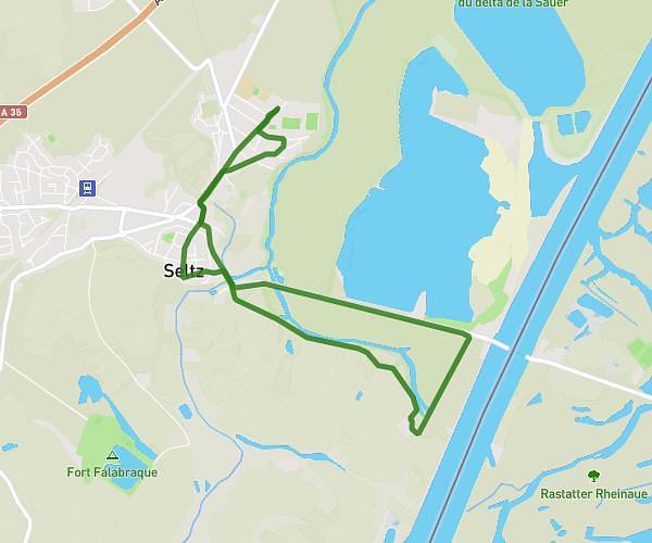
This walking route covers 3.408mi starting from Rœschwoog, Bas-Rhin. The walk is a loop trail and returns to the trailhead. This walk is rated as easy, plan for about 1h to complete it. The route has an elevation gain of 125ft and an elevation loss of 125ft.
After work Gassi
Route details
17:37/mi
Pace
245 kcal
Calories burned
Loop trail
Route type
374ft
Min altitude
394ft
Max altitude
Route profile
125ft
Elevation gain
125ft
Elevation loss
374ft
Min altitude
394ft
Max altitude
How to get there
Trailhead: 15 Rue Ruestelpfad, 67480 Rœschwoog, France
GPS coordinates of the trailhead: 48.831606, 8.034417 / 48°49'53'' N, 8°2'3'' E