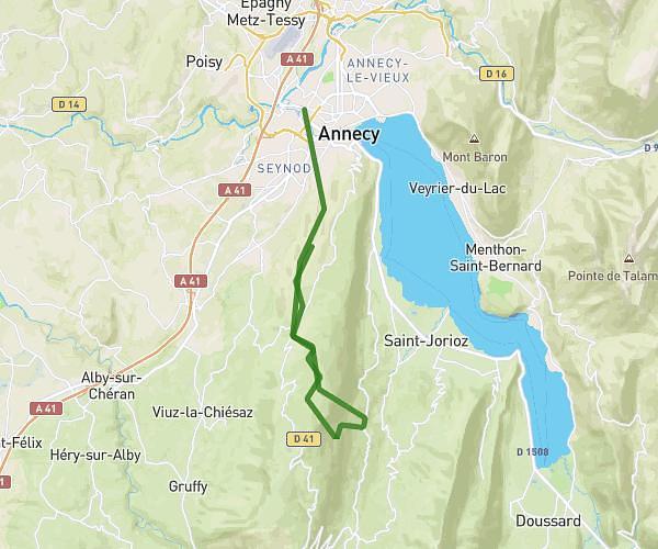
This running route covers 2.582mi starting from Villaz, Haute-Savoie. The run is a loop trail and returns to the trailhead. This run is rated as easy, expect about 1h8m to complete it. The route has an elevation gain of 272ft and an elevation loss of 269ft.
Maison cimetière les mivres
Route details
2.26mph
Speed
783 kcal
Calories burned
Loop trail
Route type
2185ft
Min altitude
2388ft
Max altitude
Route profile
272ft
Elevation gain
269ft
Elevation loss
2185ft
Min altitude
2388ft
Max altitude
How to get there
Trailhead: Allée Du Pré Corlet, 74370 Villaz
GPS coordinates of the trailhead: 45.94779, 6.18597 / 45°56'52'' N, 6°11'9'' E