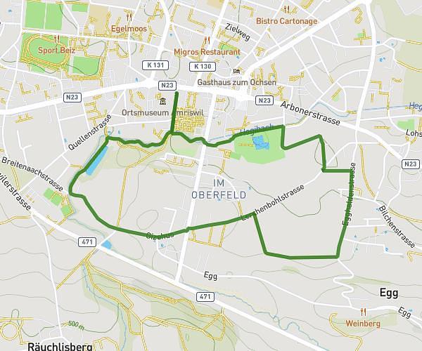
This walking route covers 1.761mi starting from Amriswil, Thurgau. The walk does not return to the trailhead and ends near Kutschenweg 15, 8580 Amriswil, Switzerland. This walk is rated as easy, plan for about 38m to complete it. The route has an elevation gain of 197ft and an elevation loss of 154ft.
Wimmelweg Amriswil 2025
Route details
21:36/mi
Pace
155 kcal
Calories burned
Point to point
Route type
1467ft
Min altitude
1516ft
Max altitude
Route profile
197ft
Elevation gain
154ft
Elevation loss
1467ft
Min altitude
1516ft
Max altitude
How to get there
Trailhead: Arbonerstrasse 3, 8580 Amriswil, Switzerland
GPS coordinates of the trailhead: 47.545287, 9.29907 / 47°32'43'' N, 9°17'56'' E