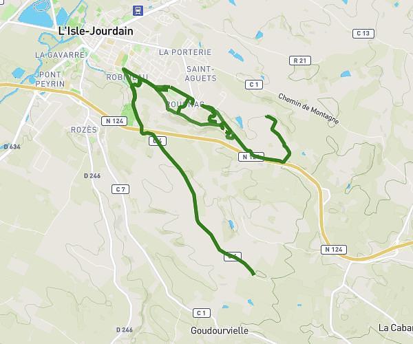
This walking route covers 5.606mi starting from Mauvezin, Gers. The walk is a loop trail and returns to the trailhead. This walk is rated as hard, plan for about 2h to complete it. The route has an elevation gain of 115ft and an elevation loss of 151ft.
rando Pompier
Route details
21:25/mi
Pace
490 kcal
Calories burned
Loop trail
Route type
499ft
Min altitude
653ft
Max altitude
Route profile
115ft
Elevation gain
151ft
Elevation loss
499ft
Min altitude
653ft
Max altitude
How to get there
Trailhead: Chemin De Lamothe, 32120 Mauvezin, France
GPS coordinates of the trailhead: 43.74309, 0.84395 / 43°44'35'' N, 0°50'38'' E