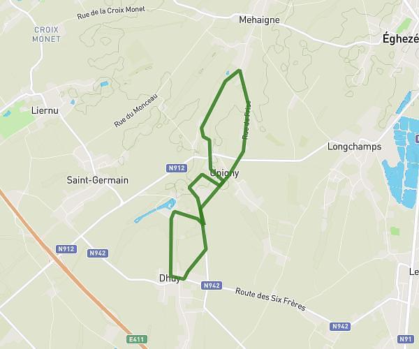
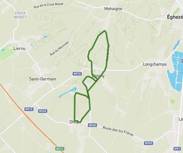
This running route covers 4.376mi starting from Wanze, Liege. The run is a loop trail and returns to the trailhead. This run is rated as easy, expect about 42m to complete it. The route has an elevation gain of 184ft and an elevation loss of 184ft.
Antheit
Route details
6.25mph
Speed
480 kcal
Calories burned
Loop trail
Route type
236ft
Min altitude
361ft
Max altitude
Route profile
184ft
Elevation gain
184ft
Elevation loss
236ft
Min altitude
361ft
Max altitude
How to get there
Trailhead: Chaussée De Tirlemont 206, 4520 Wanze, Liege, Belgium
GPS coordinates of the trailhead: 50.54919, 5.22271 / 50°32'57'' N, 5°13'21'' E