MapPlanner
0.976mi
Distance
21m
Duration
21:30/mi
Pace
Easy
Level

Haven Local Walk 1

Route details

21:30/mi
Pace
86 kcal
Calories burned
Loop trail
Route type
312ft
Min altitude
413ft
Max altitude

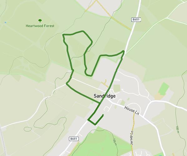
This walking route covers 0.976mi starting from Hemel Hempstead, England. The walk is a loop trail and returns to the trailhead. This walk is rated as easy, plan for about 21m to complete it. The route has an elevation gain of 112ft and an elevation loss of 108ft.

Description of the route by the creator

A 1.5KM, 30 min slow walk (off road)

Route profile

112ft
Elevation gain
108ft
Elevation loss
312ft
Min altitude
413ft
Max altitude

How to get there

Trailhead: Wolsey Road, HP2 4TU Hemel Hempstead

GPS coordinates of the trailhead: 51.74781, -0.4709 / 51°44'52'' N, 0°28'15'' W

Caution: May Cross Private Property

This route may pass through or near private property. Always respect posted signs, obtain permission where required, and follow local trespassing laws. MapPlanner does not guarantee public access along any route.

Safety Notice

Trail and road conditions may change without notice due to weather, construction, or other factors. Always verify current conditions before heading out. You are responsible for your own safety — follow local signage, obey traffic laws, and use your best judgment on the trail.