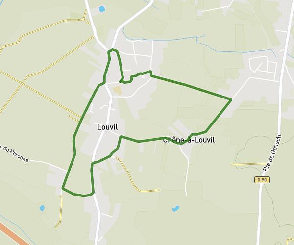
This running route covers 3.966mi starting from Tournai, Hainaut. The run is a loop trail and returns to the trailhead. This run is rated as easy, expect about 42m32s to complete it. The route has an elevation gain of 292ft and an elevation loss of 292ft.
Course AMDPS 6 KM
Route details
5.59mph
Speed
486 kcal
Calories burned
Loop trail
Route type
52ft
Min altitude
223ft
Max altitude
Route profile
292ft
Elevation gain
292ft
Elevation loss
52ft
Min altitude
223ft
Max altitude
How to get there
Trailhead: Rue Montgomery 71, 7540 Tournai, Hainaut, Belgium
GPS coordinates of the trailhead: 50.63034, 3.387442 / 50°37'49'' N, 3°23'14'' E