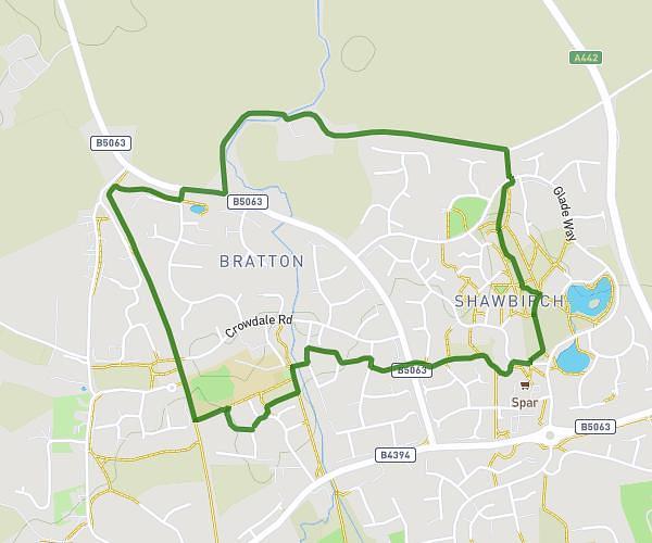
This walking route covers 3.488mi starting from Newport, England. The walk is a loop trail and returns to the trailhead. This walk is rated as moderate, plan for about 1h24m to complete it. The route has an elevation gain of 177ft and an elevation loss of 177ft.
Newport to Edgmond fields and canal
Route details
24:08/mi
Pace
344 kcal
Calories burned
Loop trail
Route type
194ft
Min altitude
276ft
Max altitude
Route profile
177ft
Elevation gain
177ft
Elevation loss
194ft
Min altitude
276ft
Max altitude
How to get there
Trailhead: 7 Strine Way, Newport, TF10 7RJ, United Kingdom
GPS coordinates of the trailhead: 52.774896, -2.375961 / 52°46'29'' N, 2°22'33'' W