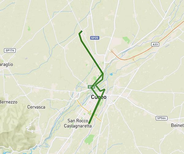
This running route covers 9.105mi starting from Cuneo, Cuneo. The run is a loop trail and returns to the trailhead. This run is rated as hard, expect about 1h38m to complete it. The route has an elevation gain of 171ft and an elevation loss of 194ft.
Corsa
Route details
5.57mph
Speed
1120 kcal
Calories burned
Loop trail
Route type
1716ft
Min altitude
1909ft
Max altitude
Route profile
171ft
Elevation gain
194ft
Elevation loss
1716ft
Min altitude
1909ft
Max altitude
How to get there
Trailhead: Via Carolina Invernizio 1, 12100 Cuneo Cuneo, Italy
GPS coordinates of the trailhead: 44.36671, 7.53578 / 44°22'0'' N, 7°32'8'' E