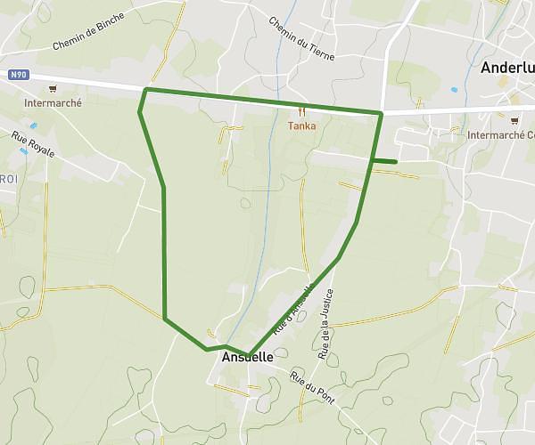
This running route covers 0.92mi starting from Frameries, Hainaut. The run is a loop trail and returns to the trailhead. This run is rated as easy, expect about 8m to complete it. The route has an elevation gain of 121ft and an elevation loss of 121ft.
Terril du Grand Trait
Route details
6.9mph
Speed
91 kcal
Calories burned
Loop trail
Route type
351ft
Min altitude
433ft
Max altitude
Route profile
121ft
Elevation gain
121ft
Elevation loss
351ft
Min altitude
433ft
Max altitude
How to get there
Trailhead: Rue De Lambrechies 79, 7080 Frameries, Hainaut, Belgium
GPS coordinates of the trailhead: 50.41124, 3.8827 / 50°24'40'' N, 3°52'57'' E