MapPlanner
15.035mi
Distance
2h
Duration
7.52mph
Speed
+30ft
Elevation gain
-39ft
Elevation loss
Easy
Level

Ayer

Route details

1051 kcal
Calories burned
0.1%
Avg grade
Loop trail
Route type
584ft
Min altitude
610ft
Max altitude

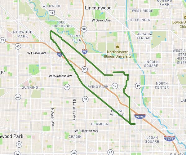
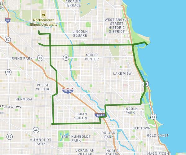
This cycling route covers 15.035mi starting from Chicago, Illinois. The ride is a loop trail and returns to the trailhead. This route is rated as easy, plan for about 2h to complete it. The route has an elevation gain of 30ft and an elevation loss of 39ft.

Route profile

30ft
Elevation gain
39ft
Elevation loss
584ft
Min altitude
610ft
Max altitude

How to get there

Trailhead: 3754 West Sunnyside Avenue, Chicago, Illinois 60625, United States

GPS coordinates of the trailhead: 41.96284, -87.72258 / 41°57'46'' N, 87°43'21'' W

Caution: May Cross Private Property

This route may pass through or near private property. Always respect posted signs, obtain permission where required, and follow local trespassing laws. MapPlanner does not guarantee public access along any route.

Safety Notice

Trail and road conditions may change without notice due to weather, construction, or other factors. Always verify current conditions before heading out. You are responsible for your own safety — follow local signage, obey traffic laws, and use your best judgment on the trail.