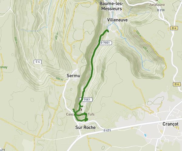
This hiking trail covers 0.229mi starting from Le Vaudioux, Jura. The hike is a loop trail and returns to the trailhead. This hike is rated as easy, plan for about 7m22s to complete it. The route has an elevation gain of 62ft and an elevation loss of 184ft.
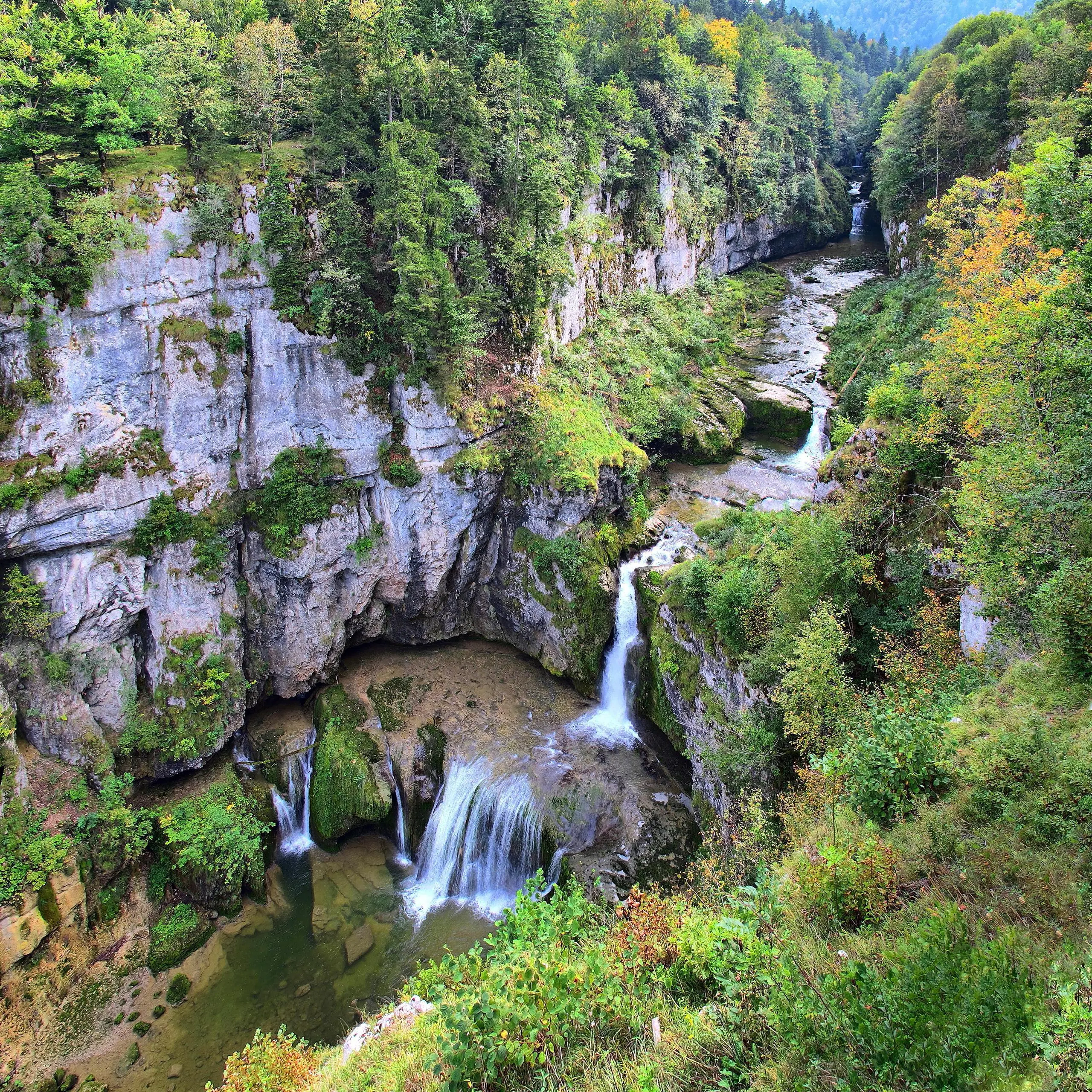
Cascade de la Billaude
Route details
1.86mph
Speed
56 kcal
Calories burned
20.3%
Avg grade
Loop trail
Route type
1900ft
Min altitude
2028ft
Max altitude
Steep climb
Route profile
62ft
Elevation gain
184ft
Elevation loss
1900ft
Min altitude
2028ft
Max altitude
How to get there
Trailhead: 9 Route Des Cascades, 39300 Le Vaudioux, France
GPS coordinates of the trailhead: 46.68137, 5.93691 / 46°40'52'' N, 5°56'12'' E