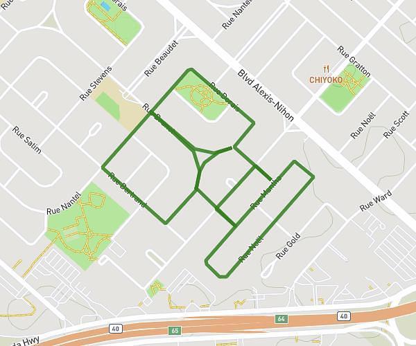
This walking route covers 3.581mi starting from Boucherville, Quebec. The walk is a loop trail and returns to the trailhead. This walk is rated as moderate, plan for about 2s to complete it. The route has an elevation gain of 135ft and an elevation loss of 135ft.
Boucle Normandie
Route details
0:01/mi
Pace
-
Calories burned
Loop trail
Route type
46ft
Min altitude
102ft
Max altitude
Route profile
135ft
Elevation gain
135ft
Elevation loss
46ft
Min altitude
102ft
Max altitude
How to get there
Trailhead: 739 Rue Catherine Des Granches, Boucherville, Quebec J4B 7S1, Canada
GPS coordinates of the trailhead: 45.604749, -73.42634 / 45°36'17'' N, 73°25'34'' W