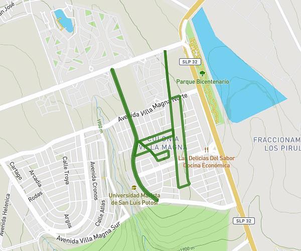
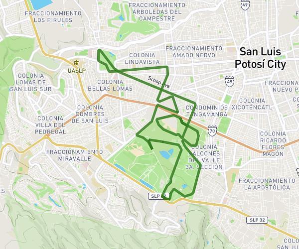
This running route covers 10.145mi starting from San Luis Potosí, San Luis Potosí. The run is a loop trail and returns to the trailhead. This run is rated as hard, expect about 1h49m to complete it. The route has an elevation gain of 463ft and an elevation loss of 463ft.
16km
Route details
5.59mph
Speed
1246 kcal
Calories burned
Loop trail
Route type
6175ft
Min altitude
6404ft
Max altitude
Route profile
463ft
Elevation gain
463ft
Elevation loss
6175ft
Min altitude
6404ft
Max altitude
How to get there
Trailhead: Avenida Cordillera Himalaya 749, 78216 San Luis Potosí, San Luis Potosí, Mexico
GPS coordinates of the trailhead: 22.142741, -101.03408 / 22°8'33'' N, 101°2'2'' W