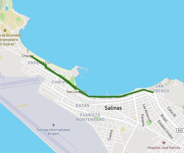
This running route covers 11.299mi starting from Salinas, Santa Elena. The run does not return to the trailhead and ends near Avenida Malecón, Salinas - Santa Elena, 2402, Ecuador. This run is rated as strenuous, expect about 2h1m to complete it. The route has an elevation gain of 860ft and an elevation loss of 860ft.
18k
Route details
5.59mph
Speed
1386 kcal
Calories burned
Point to point
Route type
7ft
Min altitude
98ft
Max altitude
Route profile
860ft
Elevation gain
860ft
Elevation loss
7ft
Min altitude
98ft
Max altitude
How to get there
Trailhead: Avenida Malecón, Salinas - Santa Elena, 2402, Ecuador
GPS coordinates of the trailhead: -2.1972, -80.984172 / 2°11'49'' S, 80°59'3'' W