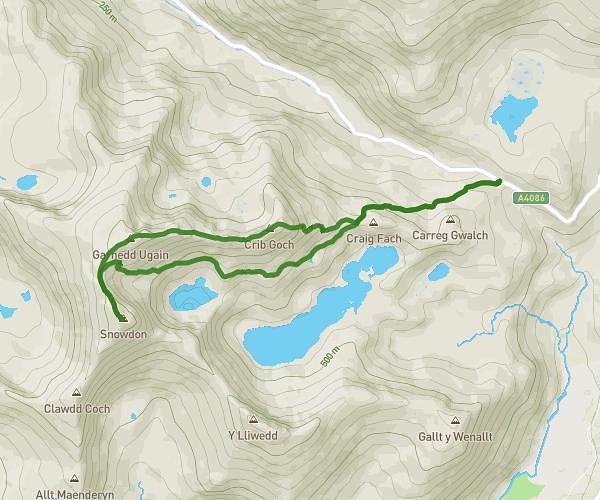
This hiking trail covers 7.779mi starting from Caernarfon, Wales. The hike is a loop trail and returns to the trailhead. This hike is rated as strenuous, plan for about 4h27m to complete it. The route has an elevation gain of 2946ft and an elevation loss of 2907ft.
Moel Hebog
Route details
1.75mph
Speed
2092 kcal
Calories burned
14.3%
Avg grade
Loop trail
Route type
157ft
Min altitude
2539ft
Max altitude
Steep climb
Route profile
2946ft
Elevation gain
2907ft
Elevation loss
157ft
Min altitude
2539ft
Max altitude
How to get there
Trailhead: 33 Oberon Wood, Beddgelert, Caernarfon, LL55 4YW, United Kingdom
GPS coordinates of the trailhead: 53.011095, -4.106057 / 53°0'39'' N, 4°6'21'' W