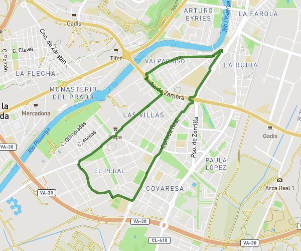
This running route covers 5.005mi starting from Valladolid, Valladolid. The run is a loop trail and returns to the trailhead. This run is rated as moderate, expect about 42m to complete it. The route has an elevation gain of 128ft and an elevation loss of 98ft.
Contiendas
Route details
7.15mph
Speed
480 kcal
Calories burned
Loop trail
Route type
2238ft
Min altitude
2365ft
Max altitude
Route profile
128ft
Elevation gain
98ft
Elevation loss
2238ft
Min altitude
2365ft
Max altitude
How to get there
Trailhead: Calle Del Monasterio Santa María De Moreruela 22, 47015 Valladolid, Valladolid, Spain
GPS coordinates of the trailhead: 41.645321, -4.746232 / 41°38'43'' N, 4°44'46'' W