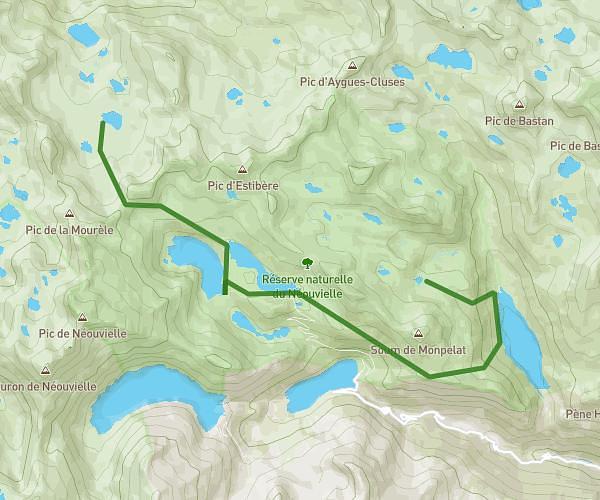
This walking route covers 7.873mi starting from Bagnères-de-Bigorre, Hautes-Pyrénées. The walk does not return to the trailhead and ends near 65170, Saint-Lary-Soulan, Hautes-Pyrénées, France. This walk is rated as strenuous, plan for about 2h49m to complete it. The route has an elevation gain of 3547ft and an elevation loss of 4547ft.
jours2
Route details
21:27/mi
Pace
690 kcal
Calories burned
Point to point
Route type
5984ft
Min altitude
8258ft
Max altitude
Route profile
3547ft
Elevation gain
4547ft
Elevation loss
5984ft
Min altitude
8258ft
Max altitude
How to get there
Trailhead: 65200, Bagnères-de-Bigorre, Hautes-Pyrénées, France
GPS coordinates of the trailhead: 42.886852, 0.20537 / 42°53'12'' N, 0°12'19'' E