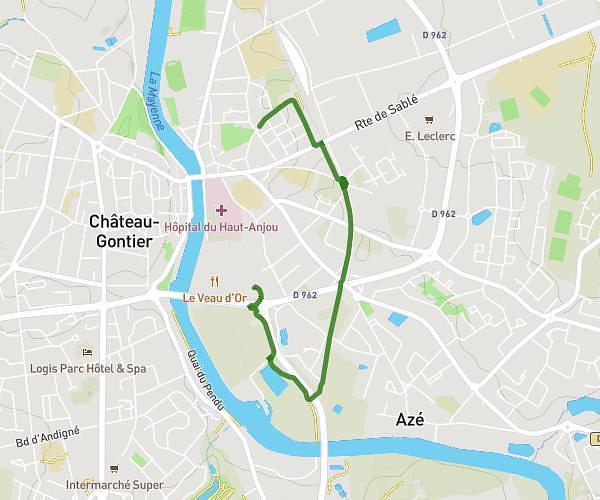
This running route covers 6.7mi starting from Château-Gontier-sur-Mayenne, Mayenne. The run is a loop trail and returns to the trailhead. This run is rated as moderate, expect about 1h4m to complete it. The route has an elevation gain of 397ft and an elevation loss of 394ft.
Voie verte
Route details
6.21mph
Speed
740 kcal
Calories burned
Loop trail
Route type
79ft
Min altitude
194ft
Max altitude
Route profile
397ft
Elevation gain
394ft
Elevation loss
79ft
Min altitude
194ft
Max altitude
How to get there
Trailhead: 1 Allée René Maisonneuve, 53200 Château-Gontier-sur-Mayenne, France
GPS coordinates of the trailhead: 47.82094, -0.70756 / 47°49'15'' N, 0°42'27'' W