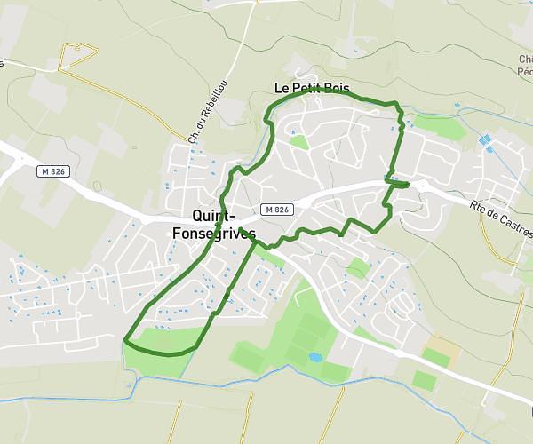
This walking route covers 1.418mi starting from Pechbonnieu, Haute-Garonne. The walk is a loop trail and returns to the trailhead. This walk is rated as easy, plan for about 34m13s to complete it. The route has an elevation gain of 95ft and an elevation loss of 95ft.
Montberon
Route details
24:08/mi
Pace
140 kcal
Calories burned
Loop trail
Route type
505ft
Min altitude
571ft
Max altitude
Route profile
95ft
Elevation gain
95ft
Elevation loss
505ft
Min altitude
571ft
Max altitude
How to get there
Trailhead: Chemin Du Bois De La Commune, 31140 Pechbonnieu, France
GPS coordinates of the trailhead: 43.718752, 1.465725 / 43°43'7'' N, 1°27'56'' E