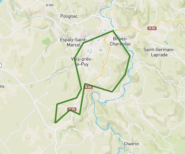
This cycling route covers 3.664mi starting from Vals-près-le-Puy, Haute-Loire. The ride does not return to the trailhead and ends near Route De Solignac, 43370 Cussac-sur-Loire. This route is rated as moderate, plan for about 22m to complete it. The route has an elevation gain of 797ft and an elevation loss of 118ft.
Vals- Malpas- Rue des Pins
Route details
203 kcal
Calories burned
4.7%
Avg grade
Point to point
Route type
2169ft
Min altitude
2864ft
Max altitude
Route profile
797ft
Elevation gain
118ft
Elevation loss
2169ft
Min altitude
2864ft
Max altitude
How to get there
Trailhead: Route Du Carmel, 43750 Vals-près-le-Puy
GPS coordinates of the trailhead: 45.02654, 3.87608 / 45°1'35'' N, 3°52'33'' E