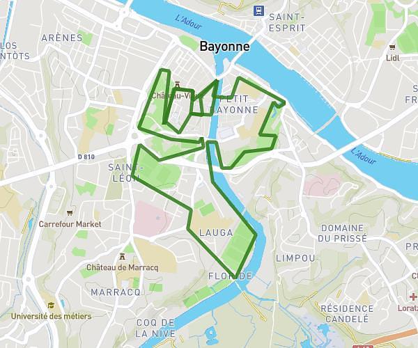
This running route covers 10.108mi starting from Bayonne, Pyrénées-Atlantiques. The run is a loop trail and returns to the trailhead. This run is rated as hard, expect about 1h46m to complete it. The route has an elevation gain of 469ft and an elevation loss of 472ft.
Ansot villefranque floride
Route details
5.72mph
Speed
1212 kcal
Calories burned
Loop trail
Route type
-3ft
Min altitude
210ft
Max altitude
Route profile
469ft
Elevation gain
472ft
Elevation loss
-3ft
Min altitude
210ft
Max altitude
How to get there
Trailhead: 13 Avenue Raoul Follereau, 64100 Bayonne, France
GPS coordinates of the trailhead: 43.478397, -1.473091 / 43°28'42'' N, 1°28'23'' W