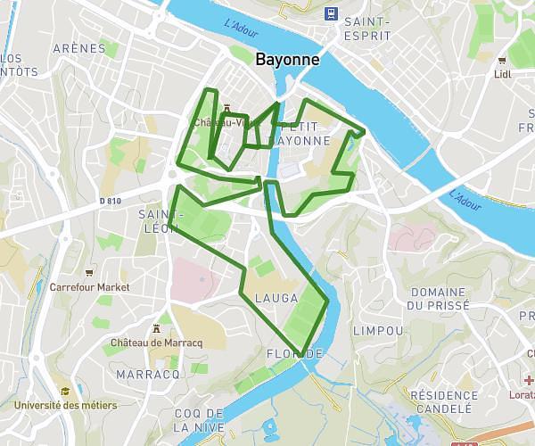
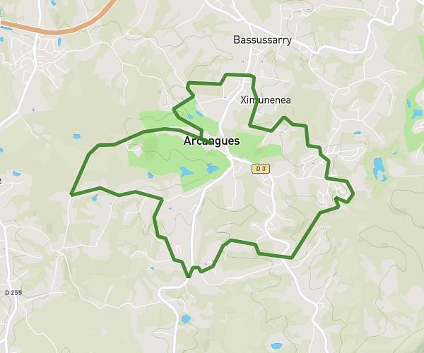
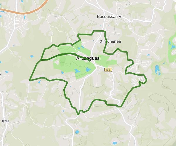
This running route covers 7.774mi starting from Mouguerre, Pyrénées-Atlantiques. The run is a loop trail and returns to the trailhead. This run is rated as hard, expect about 1h15m to complete it. The route has an elevation gain of 1010ft and an elevation loss of 1007ft.
Mouguerre
Route details
6.22mph
Speed
858 kcal
Calories burned
Loop trail
Route type
39ft
Min altitude
436ft
Max altitude
Route profile
1010ft
Elevation gain
1007ft
Elevation loss
39ft
Min altitude
436ft
Max altitude
How to get there
Trailhead: 267 Chemin D' Etxaldea, 64990 Mouguerre, France
GPS coordinates of the trailhead: 43.46086, -1.39241 / 43°27'39'' N, 1°23'32'' W