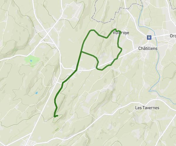
This running route covers 3.114mi starting from Lausanne, Vaud. The run is a loop trail and returns to the trailhead. This run is rated as easy, expect about 30m3s to complete it. The route has an elevation gain of 23ft and an elevation loss of 23ft.
Shake out run
Route details
6.22mph
Speed
344 kcal
Calories burned
Loop trail
Route type
1224ft
Min altitude
1237ft
Max altitude
Route profile
23ft
Elevation gain
23ft
Elevation loss
1224ft
Min altitude
1237ft
Max altitude
How to get there
Trailhead: Quai Des Savoyards, 1006 Lausanne, Switzerland
GPS coordinates of the trailhead: 46.50771, 6.62355 / 46°30'27'' N, 6°37'24'' E