MapPlanner
10.238mi
Distance
1h35m
Duration
9:17/mi
Pace
Hard
Level

Quais / Colline

Route details

6.47mph
Speed
1086 kcal
Calories burned
Loop trail
Route type
522ft
Min altitude
948ft
Max altitude

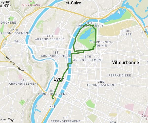
This running route covers 10.238mi starting from Lyon, Rhône. The run is a loop trail and returns to the trailhead. This run is rated as hard, expect about 1h35m to complete it. The route has an elevation gain of 837ft and an elevation loss of 840ft.

Route profile

837ft
Elevation gain
840ft
Elevation loss
522ft
Min altitude
948ft
Max altitude

How to get there

Trailhead: Rue De Boyer, 69005 Lyon

GPS coordinates of the trailhead: 45.75864, 4.78481 / 45°45'31'' N, 4°47'5'' E

Caution: May Cross Private Property

This route may pass through or near private property. Always respect posted signs, obtain permission where required, and follow local trespassing laws. MapPlanner does not guarantee public access along any route.

Safety Notice

Trail and road conditions may change without notice due to weather, construction, or other factors. Always verify current conditions before heading out. You are responsible for your own safety — follow local signage, obey traffic laws, and use your best judgment on the trail.