MapPlanner
4.035mi
Distance
39m1s
Duration
9:41/mi
Pace
Easy
Level

Johan

Route details

6.2mph
Speed
446 kcal
Calories burned
Loop trail
Route type
141ft
Min altitude
233ft
Max altitude

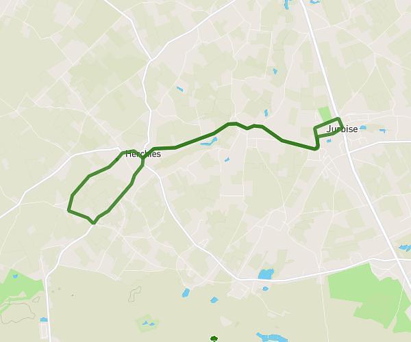
This running route covers 4.035mi starting from Silly, Hainaut. The run is a loop trail and returns to the trailhead. This run is rated as easy, expect about 39m1s to complete it. The route has an elevation gain of 46ft and an elevation loss of 92ft.

Route profile

46ft
Elevation gain
92ft
Elevation loss
141ft
Min altitude
233ft
Max altitude

How to get there

Trailhead: Rue Wastinelle, 7830 Silly

GPS coordinates of the trailhead: 50.65174, 3.92657 / 50°39'6'' N, 3°55'35'' E

Caution: May Cross Private Property

This route may pass through or near private property. Always respect posted signs, obtain permission where required, and follow local trespassing laws. MapPlanner does not guarantee public access along any route.

Safety Notice

Trail and road conditions may change without notice due to weather, construction, or other factors. Always verify current conditions before heading out. You are responsible for your own safety — follow local signage, obey traffic laws, and use your best judgment on the trail.