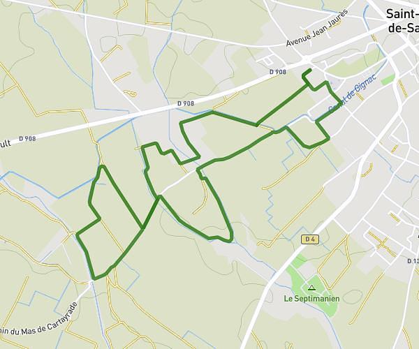
This walking route covers 1.542mi starting from Lodève, Hérault. The walk does not return to the trailhead and ends near Chemin De Grézac, 34700 Lodève, France. This walk is rated as easy, plan for about 33m to complete it. The route has an elevation gain of 1017ft and an elevation loss of 20ft.
Oppidum Grézac
Route details
21:25/mi
Pace
135 kcal
Calories burned
Point to point
Route type
587ft
Min altitude
1585ft
Max altitude
Route profile
1017ft
Elevation gain
20ft
Elevation loss
587ft
Min altitude
1585ft
Max altitude
How to get there
Trailhead: Parc Municipal, 34700 Lodève, France
GPS coordinates of the trailhead: 43.732918, 3.315244 / 43°43'58'' N, 3°18'54'' E