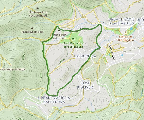
This hiking trail covers 16.697mi starting from Serra, Valencia. The hike is a loop trail and returns to the trailhead. This hike is rated as strenuous, plan for about 3h35m to complete it. The route has an elevation gain of 4242ft and an elevation loss of 4242ft.
SALIDA PRUEBA FEB 2026 CHEMI
Route details
4.66mph
Speed
1626 kcal
Calories burned
9.6%
Avg grade
Loop trail
Route type
689ft
Min altitude
2569ft
Max altitude
Steep climb
Route profile
4242ft
Elevation gain
4242ft
Elevation loss
689ft
Min altitude
2569ft
Max altitude
How to get there
Trailhead: Cv-331, 46118 Serra, Valencia, Spain
GPS coordinates of the trailhead: 39.661715, -0.480963 / 39°39'42'' N, 0°28'51'' W