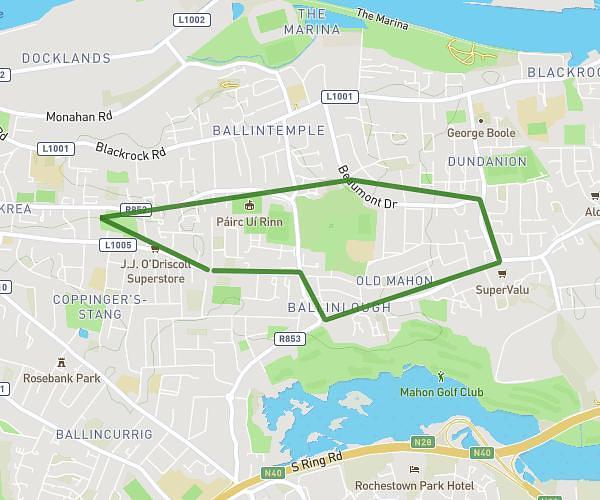
This running route covers 3.601mi starting from Lehenagh, Cork. The run is a loop trail and returns to the trailhead. This run is rated as easy, expect about 39m to complete it. The route has an elevation gain of 49ft and an elevation loss of 36ft.
5.7km
Route details
5.54mph
Speed
446 kcal
Calories burned
Loop trail
Route type
39ft
Min altitude
85ft
Max altitude
Route profile
49ft
Elevation gain
36ft
Elevation loss
39ft
Min altitude
85ft
Max altitude
How to get there
Trailhead: Swan's Nest Business Park, Lehenagh, Cork T12, Ireland
GPS coordinates of the trailhead: 51.871517, -8.488515 / 51°52'17'' N, 8°29'18'' W