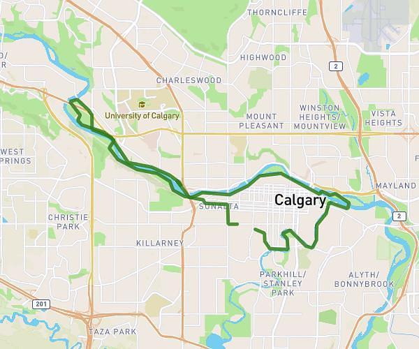
This running route covers 12.514mi starting from Calgary, Alberta. The run is a loop trail and returns to the trailhead. This run is rated as strenuous, expect about 1h54m to complete it. The route has an elevation gain of 1325ft and an elevation loss of 1329ft.
Around the reservoir Half
Route details
6.58mph
Speed
1305 kcal
Calories burned
Loop trail
Route type
3514ft
Min altitude
3635ft
Max altitude
Route profile
1325ft
Elevation gain
1329ft
Elevation loss
3514ft
Min altitude
3635ft
Max altitude
How to get there
Trailhead: 1504 50 Avenue SW, Calgary, Alberta T2T 4B6, Canada
GPS coordinates of the trailhead: 51.00862, -114.095683 / 51°0'31'' N, 114°5'44'' W