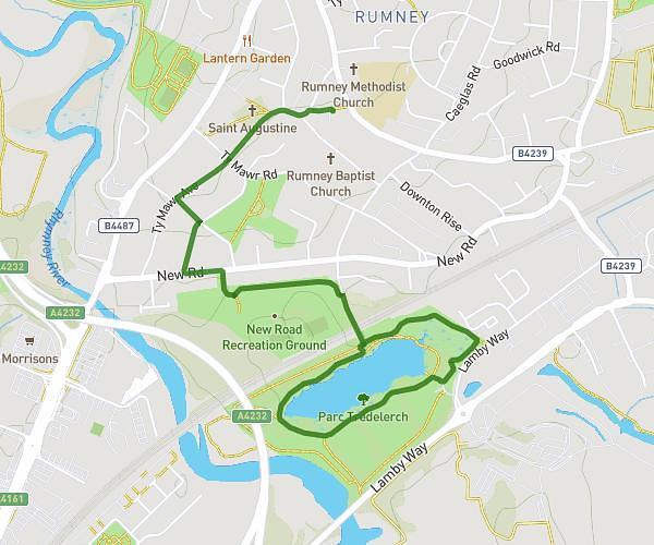
This walking route covers 1.709mi starting from Newport, Wales. The walk is a loop trail and returns to the trailhead. This walk is rated as easy, plan for about 25m to complete it. The route has an elevation gain of 171ft and an elevation loss of 177ft.
Round the block twice
Route details
14:38/mi
Pace
102 kcal
Calories burned
Loop trail
Route type
85ft
Min altitude
161ft
Max altitude
Route profile
171ft
Elevation gain
177ft
Elevation loss
85ft
Min altitude
161ft
Max altitude
How to get there
Trailhead: Glasllwch View, NP20 3RJ Newport
GPS coordinates of the trailhead: 51.57925, -3.03488 / 51°34'45'' N, 3°2'5'' W