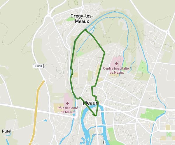
This running route covers 3.118mi starting from Meaux, Seine-et-Marne. The run does not return to the trailhead and ends near Rue Du Faubourg Saint-Nicolas, 77100 Meaux. This run is rated as easy, expect about 43m to complete it. The route has an elevation gain of 102ft and an elevation loss of 105ft.
5km
Route details
4.35mph
Speed
492 kcal
Calories burned
Point to point
Route type
154ft
Min altitude
200ft
Max altitude
Route profile
102ft
Elevation gain
105ft
Elevation loss
154ft
Min altitude
200ft
Max altitude
How to get there
Trailhead: Avenue Du Président Roosevelt, 77100 Meaux
GPS coordinates of the trailhead: 48.95735, 2.89476 / 48°57'26'' N, 2°53'41'' E