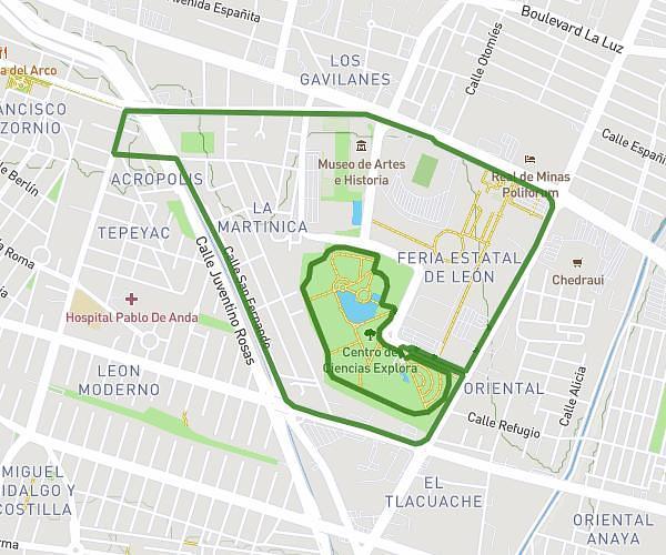
This running route covers 13.157mi starting from León, Guanajuato. The run does not return to the trailhead and ends near Boulevard General Francisco Villa 403, 37500 León, Guanajuato, Mexico. This run is rated as strenuous, expect about 2h7m to complete it. The route has an elevation gain of 755ft and an elevation loss of 774ft.
Preparativo medio maratón
Route details
6.21mph
Speed
1454 kcal
Calories burned
Point to point
Route type
5869ft
Min altitude
5948ft
Max altitude
Route profile
755ft
Elevation gain
774ft
Elevation loss
5869ft
Min altitude
5948ft
Max altitude
How to get there
Trailhead: Boulevard General Francisco Villa 214, 37500 León, Guanajuato, Mexico
GPS coordinates of the trailhead: 21.1092, -101.656417 / 21°6'33'' N, 101°39'23'' W