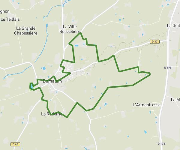
This running route covers 2.639mi starting from Janzé, Ille-et-Vilaine. The run is a loop trail and returns to the trailhead. This run is rated as easy, expect about 23m9s to complete it. The route has an elevation gain of 128ft and an elevation loss of 128ft.
Janzé
Route details
6.84mph
Speed
265 kcal
Calories burned
Loop trail
Route type
203ft
Min altitude
262ft
Max altitude
Route profile
128ft
Elevation gain
128ft
Elevation loss
203ft
Min altitude
262ft
Max altitude
How to get there
Trailhead: 12 Rue De Belle-Île, 35150 Janzé, France
GPS coordinates of the trailhead: 47.95236, -1.49257 / 47°57'8'' N, 1°29'33'' W