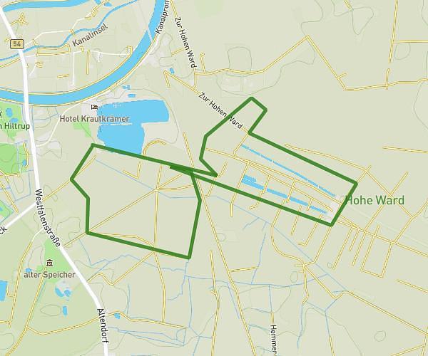
This running route covers 6.329mi starting from Hamm, North Rhine-Westphalia. The run is a loop trail and returns to the trailhead. This run is rated as moderate, expect about 1h8m to complete it. The route has an elevation gain of 13ft and an elevation loss of 13ft.
WLM 22026 10km
Route details
5.59mph
Speed
777 kcal
Calories burned
Loop trail
Route type
194ft
Min altitude
207ft
Max altitude
Route profile
13ft
Elevation gain
13ft
Elevation loss
194ft
Min altitude
207ft
Max altitude
How to get there
Trailhead: Arthur-Dewitz-Straße 3, 59065 Hamm, Germany
GPS coordinates of the trailhead: 51.688367, 7.83118 / 51°41'18'' N, 7°49'52'' E