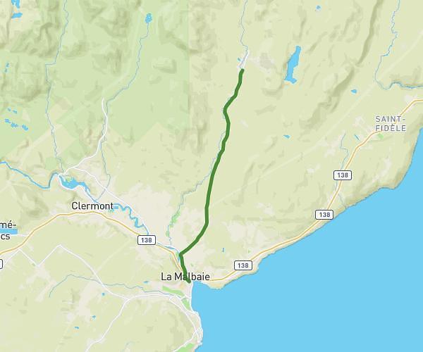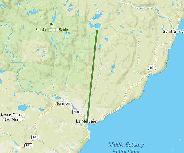

This hiking trail covers 12.944mi starting from La Malbaie, Quebec. The hike does not return to the trailhead and ends near Rang Sainte-Philomène, G5A 2B5 La Malbaie. This hike is rated as hard, plan for about 8h51m to complete it. The route has an elevation gain of 1818ft and an elevation loss of 387ft.
Description of the route by the creator
For more information about the Notre Dame de Quebec Trail, visit: <a rel="noopener noreferrer" target="_blank" href="https://www.kapoah.com">https://www.kapoah.com</a> Day 1: <a rel="noopener noreferrer" target="_blank" href="https://www.map-planner.fr/utilisateurs/kapoah/parcours/kapoah-la-malbaie-quebec-jour-1">https://www.map-planner.fr/utilisateurs/kapoah/parcours/kapoah-la-malbaie-quebec-jour-1</a> Day 2: <a rel="noopener noreferrer" target="_blank" href="https://www.map-planner.fr/utilisateurs/kapoah/parcours/kapoah-la-malbaie-quebec-jour-2">https://www.map-planner.fr/utilisateurs/kapoah/parcours/kapoah-la-malbaie-quebec-jour-2</a> Day 3: <a rel="noopener noreferrer" target="_blank" href="https://www.map-planner.fr/utilisateurs/kapoah/parcours/kapoah-la-malbaie-quebec-jour-3">https://www.map-planner.fr/utilisateurs/kapoah/parcours/kapoah-la-malbaie-quebec-jour-3</a>