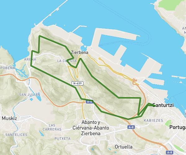
This hiking trail covers 4.356mi starting from Sestao, Biscay. The hike does not return to the trailhead and ends near Jose Antonio Agirre Y Lekube Kale Nagusia / Calle Gran Vía De José Antonio Agirre Y Lekube 50, 48910 Sestao, Biscay, Spain. This hike is rated as moderate, plan for about 1h40m to complete it. The route has an elevation gain of 548ft and an elevation loss of 489ft.
Barakaldo por Dolores Ibarruri
Route details
2.62mph
Speed
728 kcal
Calories burned
4.5%
Avg grade
Point to point
Route type
-16ft
Min altitude
194ft
Max altitude
Route profile
548ft
Elevation gain
489ft
Elevation loss
-16ft
Min altitude
194ft
Max altitude
How to get there
Trailhead: Calle Vía Amézaga 15, 48910 Sestao, Biscay, Spain
GPS coordinates of the trailhead: 43.30692, -3.00828 / 43°18'24'' N, 3°0'29'' W