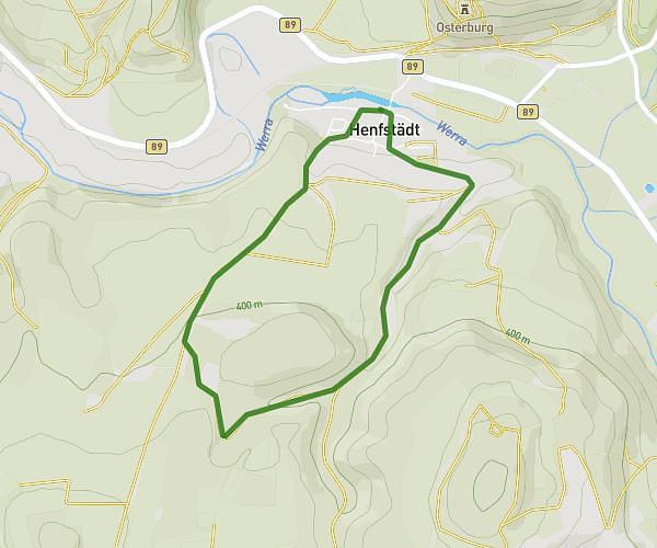
This running route covers 2.725mi starting from Henfstädt, Thuringia. The run is a loop trail and returns to the trailhead. This run is rated as easy, expect about 29m to complete it. The route has an elevation gain of 354ft and an elevation loss of 354ft.
4,3 km
Route details
5.64mph
Speed
332 kcal
Calories burned
Loop trail
Route type
1073ft
Min altitude
1368ft
Max altitude
Route profile
354ft
Elevation gain
354ft
Elevation loss
1073ft
Min altitude
1368ft
Max altitude
How to get there
Trailhead: Mittlere Dorfstraße 3, 98660 Henfstädt, Germany
GPS coordinates of the trailhead: 50.516669, 10.589593 / 50°31'0'' N, 10°35'22'' E