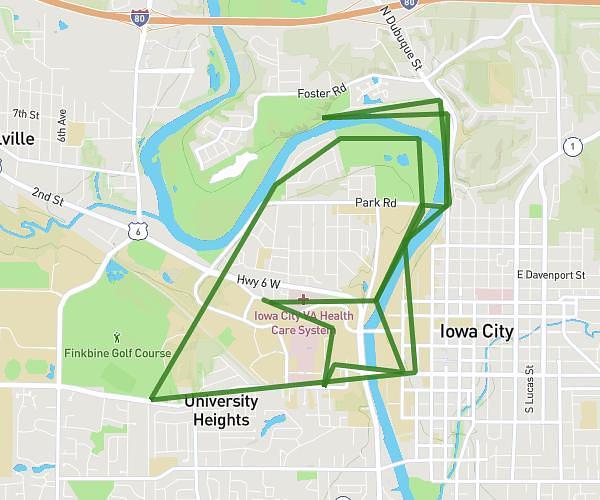
This running route covers 13.266mi starting from Iowa City, Iowa. The run is a loop trail and returns to the trailhead. This run is rated as strenuous, expect about 2h3s to complete it. The route has an elevation gain of 49ft and an elevation loss of 112ft.
Half
Route details
6.63mph
Speed
1373 kcal
Calories burned
Loop trail
Route type
653ft
Min altitude
728ft
Max altitude
Route profile
49ft
Elevation gain
112ft
Elevation loss
653ft
Min altitude
728ft
Max altitude
How to get there
Trailhead: 1004 Newton Road, Iowa City, Iowa 52246, United States
GPS coordinates of the trailhead: 41.663717, -91.552323 / 41°39'49'' N, 91°33'8'' W