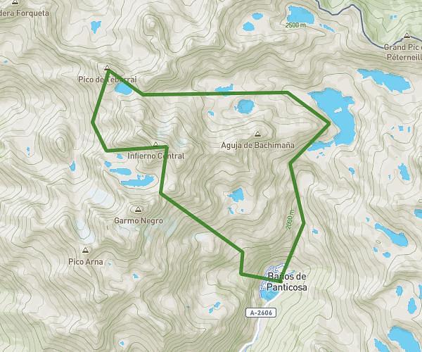
This running route covers 5.267mi starting from Argelès-Gazost, Hautes-Pyrénées. The run is a loop trail and returns to the trailhead. This run is rated as moderate, expect about 45m to complete it. The route has an elevation gain of 52ft and an elevation loss of 59ft.
Argrles/adast
Route details
7.02mph
Speed
515 kcal
Calories burned
Loop trail
Route type
1401ft
Min altitude
1460ft
Max altitude
Route profile
52ft
Elevation gain
59ft
Elevation loss
1401ft
Min altitude
1460ft
Max altitude
How to get there
Trailhead: 3 Rue Du Balaïtous, 65400 Argelès-Gazost, France
GPS coordinates of the trailhead: 42.999948, -0.090641 / 42°59'59'' N, 0°5'26'' W