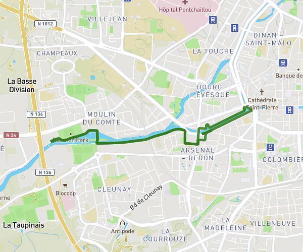
This running route covers 6.396mi starting from Rennes, Ille-et-Vilaine. The run is a loop trail and returns to the trailhead. This run is rated as moderate, expect about 47m30s to complete it. The route has an elevation gain of 187ft and an elevation loss of 187ft.
OBJECTIF TOUT RENNES COURT
Route details
8.08mph
Speed
543 kcal
Calories burned
Loop trail
Route type
75ft
Min altitude
112ft
Max altitude
Route profile
187ft
Elevation gain
187ft
Elevation loss
75ft
Min altitude
112ft
Max altitude
How to get there
Trailhead: 32 Rue Richard-Lenoir, 35000 Rennes, France
GPS coordinates of the trailhead: 48.11199, -1.66452 / 48°6'43'' N, 1°39'52'' W