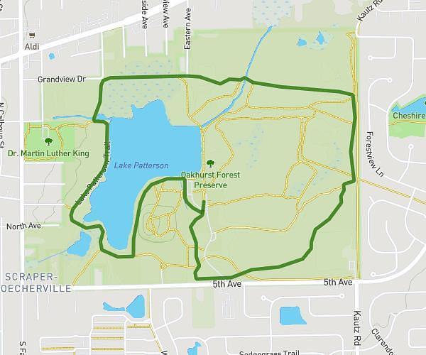
This hiking trail covers 4.801mi starting from Naperville, Illinois. The hike is a loop trail and returns to the trailhead. This hike is rated as easy, plan for about 1h35m to complete it. The route has an elevation gain of 384ft and an elevation loss of 384ft.
Herrick Lake Hike
Route details
3.0mph
Speed
689 kcal
Calories burned
3.0%
Avg grade
Loop trail
Route type
728ft
Min altitude
814ft
Max altitude
Route profile
384ft
Elevation gain
384ft
Elevation loss
728ft
Min altitude
814ft
Max altitude
How to get there
Trailhead: 2001 Lakeview Drive, Naperville, Illinois 60189, United States
GPS coordinates of the trailhead: 41.830127, -88.1441 / 41°49'48'' N, 88°8'38'' W