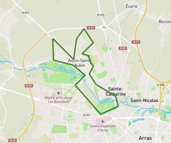
This running route covers 16.497mi starting from Raimbeaucourt, Nord. The run is a loop trail and returns to the trailhead. This run is rated as strenuous, expect about 2h56m to complete it. The route has an elevation gain of 554ft and an elevation loss of 551ft.
26km
Route details
5.59mph
Speed
2024 kcal
Calories burned
Loop trail
Route type
43ft
Min altitude
243ft
Max altitude
Route profile
554ft
Elevation gain
551ft
Elevation loss
43ft
Min altitude
243ft
Max altitude
How to get there
Trailhead: 52e Rue Du Maréchal Foch, 59283 Raimbeaucourt, France
GPS coordinates of the trailhead: 50.440533, 3.100832 / 50°26'25'' N, 3°6'2'' E