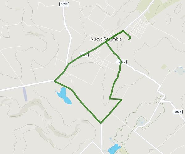
This running route covers 12.8mi starting from Nueva Colombia, Cordillera. The run does not return to the trailhead and ends near Nueva Colombia, Cordillera, 031301, Paraguay. This run is rated as strenuous, expect about 2h17m to complete it. The route has an elevation gain of 840ft and an elevation loss of 919ft.
20 Km 1 Steigung
Route details
5.6mph
Speed
1566 kcal
Calories burned
Point to point
Route type
331ft
Min altitude
843ft
Max altitude
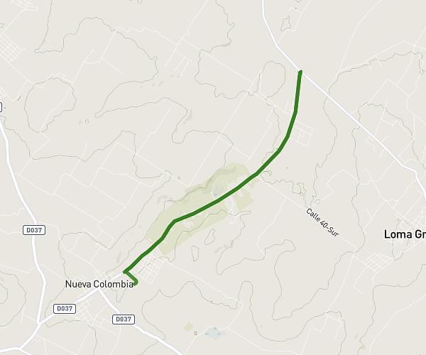
Route profile
840ft
Elevation gain
919ft
Elevation loss
331ft
Min altitude
843ft
Max altitude
How to get there
Trailhead: Nueva Colombia, Cordillera, 031301, Paraguay
GPS coordinates of the trailhead: -25.187995, -57.297521 / 25°11'16'' S, 57°17'51'' W