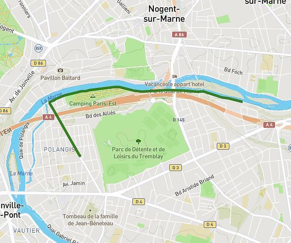
This running route covers 6.037mi starting from Le Perreux-sur-Marne, Val-de-Marne. The run is a loop trail and returns to the trailhead. This run is rated as moderate, expect about 1h7m to complete it. The route has an elevation gain of 7ft and an elevation loss of 7ft.
Sortie du 22/02/2026
Route details
5.4mph
Speed
767 kcal
Calories burned
Loop trail
Route type
121ft
Min altitude
125ft
Max altitude
Route profile
7ft
Elevation gain
7ft
Elevation loss
121ft
Min altitude
125ft
Max altitude
How to get there
Trailhead: 2 Impasse Ledru-Rollin, 94170 Le Perreux-sur-Marne, France
GPS coordinates of the trailhead: 48.850146, 2.510084 / 48°51'0'' N, 2°30'36'' E