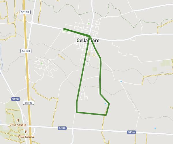
This walking route covers 3.147mi starting from Cellamare, Bari. The walk is a loop trail and returns to the trailhead. This walk is rated as moderate, plan for about 1h7m to complete it. The route has an elevation gain of 213ft and an elevation loss of 213ft.
Cellamare tour
Route details
21:19/mi
Pace
274 kcal
Calories burned
Loop trail
Route type
351ft
Min altitude
512ft
Max altitude
Route profile
213ft
Elevation gain
213ft
Elevation loss
351ft
Min altitude
512ft
Max altitude
How to get there
Trailhead: Via Rutigliano, 70010 Cellamare Bari, Italy
GPS coordinates of the trailhead: 41.02147, 16.92193 / 41°1'17'' N, 16°55'18'' E