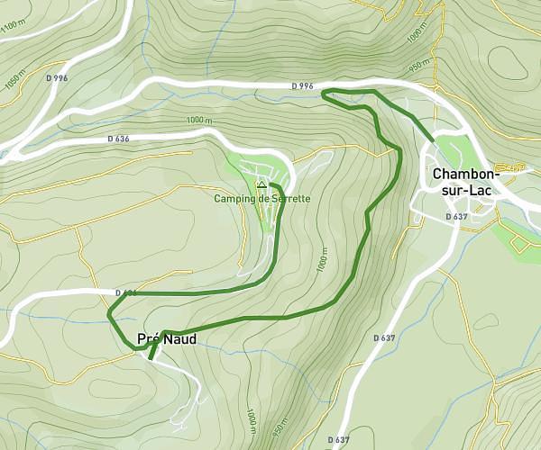
This hiking trail covers 2.369mi starting from Chambon-sur-Lac, Puy-de-Dôme. The hike does not return to the trailhead and ends near Impasse Du Murelet, 63790 Murol. This hike is rated as easy, plan for about 56m to complete it. The route has an elevation gain of 440ft and an elevation loss of 305ft.
château de Murol
Route details
2.54mph
Speed
415 kcal
Calories burned
6.0%
Avg grade
Point to point
Route type
2861ft
Min altitude
3219ft
Max altitude
Route profile
440ft
Elevation gain
305ft
Elevation loss
2861ft
Min altitude
3219ft
Max altitude
How to get there
Trailhead: Impasse De Fougerousse, 63790 Chambon-sur-Lac
GPS coordinates of the trailhead: 45.57564, 2.91196 / 45°34'32'' N, 2°54'43'' E