MapPlanner
10.587mi
Distance
2h11m
Duration
12:23/mi
Pace
Hard
Level

17km

Route details

4.85mph
Speed
1498 kcal
Calories burned
Loop trail
Route type
79ft
Min altitude
89ft
Max altitude

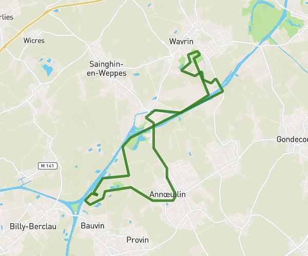
This running route covers 10.587mi starting from Annœullin, Nord. The run is a loop trail and returns to the trailhead. This run is rated as hard, expect about 2h11m to complete it. The route has an elevation gain of 10ft and an elevation loss of 13ft.

Route profile

10ft
Elevation gain
13ft
Elevation loss
79ft
Min altitude
89ft
Max altitude

How to get there

Trailhead: 57 Rue Pasteur, 59112 Annœullin, France

GPS coordinates of the trailhead: 50.526079, 2.925714 / 50°31'33'' N, 2°55'32'' E

Caution: May Cross Private Property

This route may pass through or near private property. Always respect posted signs, obtain permission where required, and follow local trespassing laws. MapPlanner does not guarantee public access along any route.

Safety Notice

Trail and road conditions may change without notice due to weather, construction, or other factors. Always verify current conditions before heading out. You are responsible for your own safety — follow local signage, obey traffic laws, and use your best judgment on the trail.