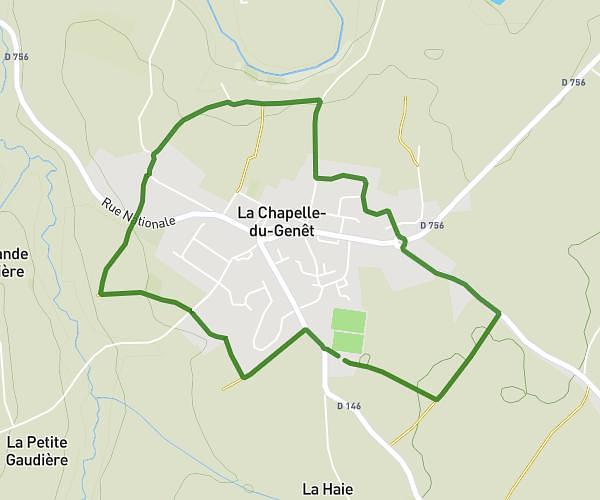
This walking route covers 2.482mi starting from Chemillé-en-Anjou, Maine-et-Loire. The walk is a loop trail and returns to the trailhead. This walk is rated as easy, plan for about 59m54s to complete it. The route has an elevation gain of 118ft and an elevation loss of 118ft.
Tour des chevaux
Route details
24:08/mi
Pace
245 kcal
Calories burned
Loop trail
Route type
262ft
Min altitude
328ft
Max altitude
Route profile
118ft
Elevation gain
118ft
Elevation loss
262ft
Min altitude
328ft
Max altitude
How to get there
Trailhead: Rue De La Tannerie, 49120 Chemillé-en-Anjou
GPS coordinates of the trailhead: 47.20662, -0.72636 / 47°12'23'' N, 0°43'34'' W