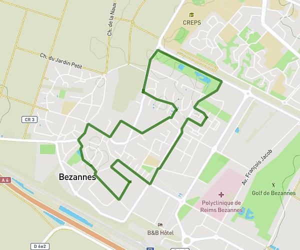
This running route covers 6.076mi starting from Reims, Marne. The run does not return to the trailhead and ends near 81 Boulevard Général Leclerc, 51100 Reims, France. This run is rated as moderate, expect about 1h20m to complete it. The route has an elevation gain of 39ft and an elevation loss of 46ft.
Run in reims 2017
Route details
4.55mph
Speed
915 kcal
Calories burned
Point to point
Route type
253ft
Min altitude
299ft
Max altitude
Route profile
39ft
Elevation gain
46ft
Elevation loss
253ft
Min altitude
299ft
Max altitude
How to get there
Trailhead: 63 Rue Libergier, 51100 Reims, France
GPS coordinates of the trailhead: 49.25079, 4.02632 / 49°15'2'' N, 4°1'34'' E